
As an occasional hiker, I have pretty high standards when it comes to a trekking experience versus those who like to hit the trails for the exercise or the routine of lacing up their well-worn hiking boots. After all, since it’s a hobby for me, not a habit, I’m in it for the reward: the spectacular view, the beautiful forest trail, the hidden waterfall, or the chance to see an animal in the wild. Those are pretty high expectations for any hike, and I like to pick and choose my destinations carefully to ensure at least some of them are met.
So when Henk and I were asked by Northeastern Ontario Tourism to hike and photo-document a whirlwind 4-day tour of the region’s 5 favourite trails, (only 1 of which I had ever hiked before) I could only hope the experience would live up to what both Henk and I were hoping. As it turned out, all of our hikes over-delivered, each for very different reasons.
So here in photos, are 5 reasons why we loved hiking these Northeastern Ontario trails and why you might, too:
Hiking Reason# 1: Waterfalls!
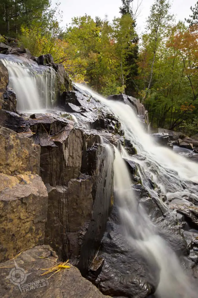
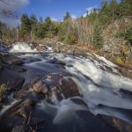
Near the highway, Duchesnay Falls tumbles over rocks in an 8-metre drop.
Who doesn’t love waterfalls! They’re like fireworks, because no matter how much you think you have seen it all before, there’s always something new or different with each experience. Which is a good description for Duchesnay Falls, a multi-tiered cascade located just west of North Bay, Ontario on Highway 17.
A short hike in from a small parking lot, Duchesnay Falls is a waterfall that not only changes throughout the year, depending on how heavy the volume of water is, but whose character changes the farther you follow it upstream, too.
Just above the final drop of the falls, a deep pool of water collects in a bedrock basin.
Hike a little higher upstream and rocky ledges create a ‘staircase effect’ as the water flows over them, and hikers can even walk along the flat rocks.

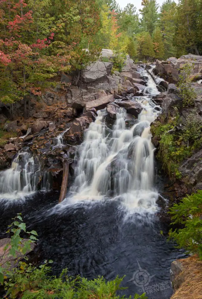
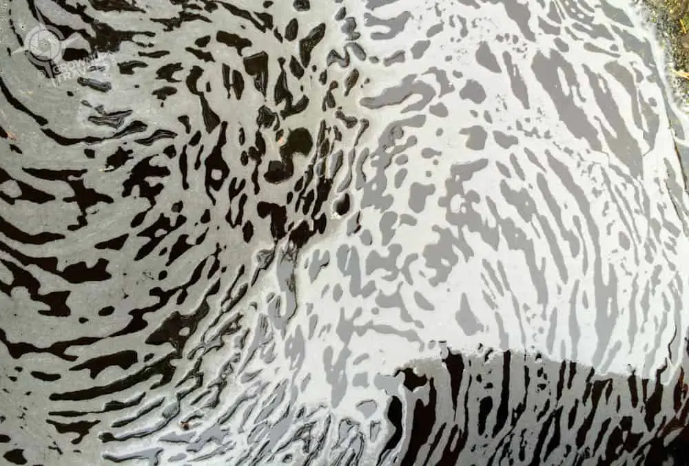
As the river flattens out even more, foaming eddies create graphic works of art along the shoreline where water pools and collects.
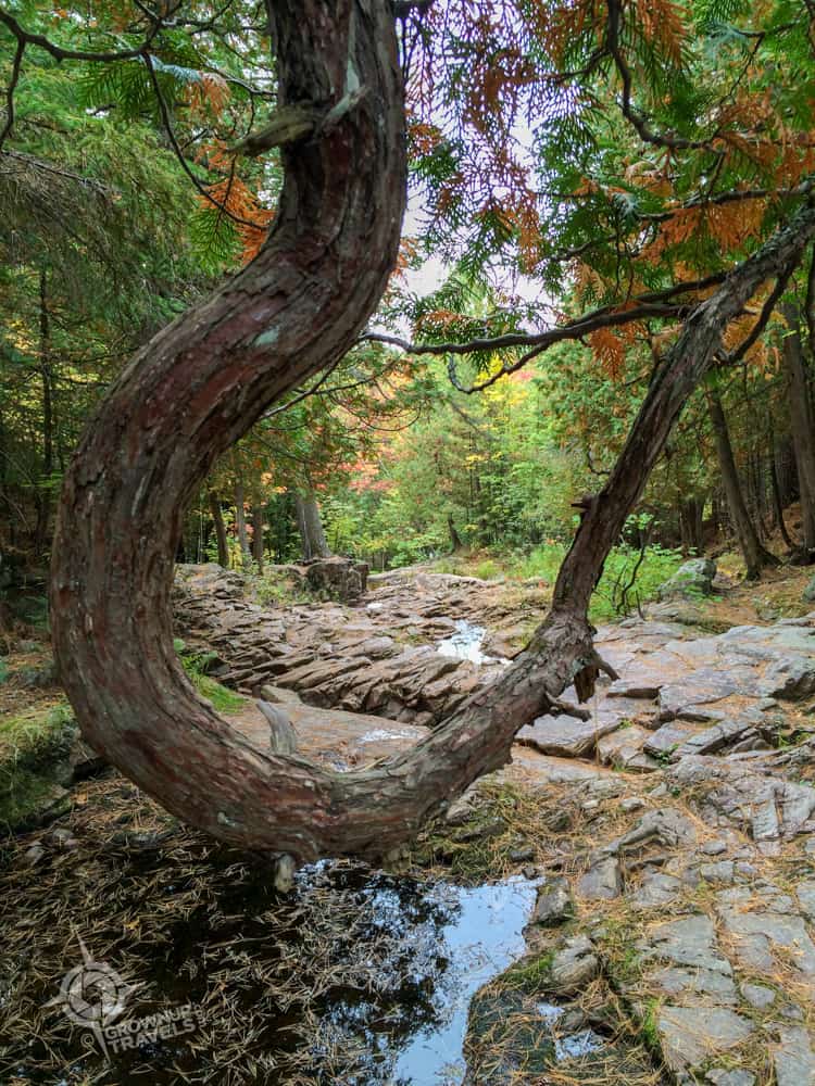
When the water volume is very high, the river actually divides into an eastern and western channel towards the bottom, but in autumn, the riverbed of the east channel is usually dry enough to allow hikers to cross over on the rocks and get interesting views from what would be mid-stream earlier in the year.
Here a hooked tree branch hanging over the river forms an unusual frame for a view of the dry riverbed.
The most popular trails run on both east and west sides of the Duchesnay river, following it upstream to a bridge where you can choose to cross to the opposite trail if you want to complete a loop back to the bottom of the falls. Or you can continue on either trail to explore more of the river.
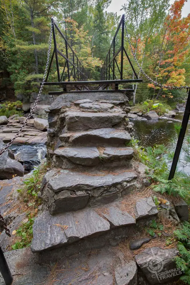
Even the bridge looks like it’s made from the rocky shoreline
The great thing about the Duchesnay Falls trail is that you can’t go wrong with either hike, as both eastern and western trails are pretty and give you great views of the multiple waterfalls which, like the rugged landscape over which it flows, have plenty of character.
Hiking Reason #2: Towering Views
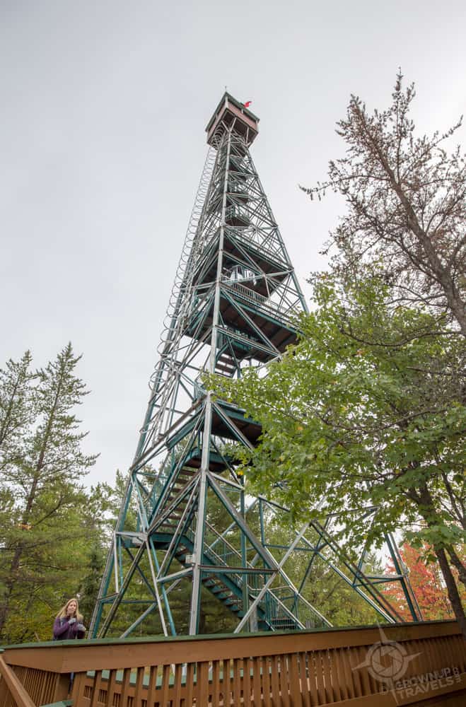
How often do you get a chance to climb up an actual Fire Rangers’ Tower? As often as you like if you make the drive to Temagami’s Caribou Mountain, where one of these historic steel towers sits on top of the highest point on Yonge Street just waiting for you to scale it. (Yes, this is the same Yonge Street of Toronto fame, but technically it has become Highway 11 this far north of the city).
Henk isn’t big on heights (he just didn’t like the look of that tapering structure with a small box balancing at the top!) but that didn’t stop me from hiking to the top and enjoying an epic 360-degree view out over Temagami’s lakes and forests. Talk about your ultimate tree house view!
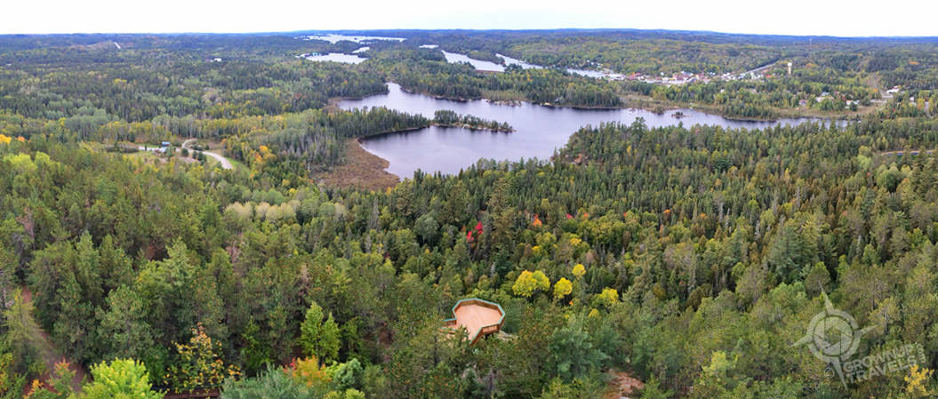
But there’s more here than just a vertical climb. Temagami’s Fire Tower is surrounded by the White Bear Forest conservation area, an 800-hectare reserve that boasts 17 kilometres of hiking trails, including some that take you through old-growth forests of red and white pine trees that are 500 years old.
Looking down from the tower you don’t realize how tall some of those trees are.
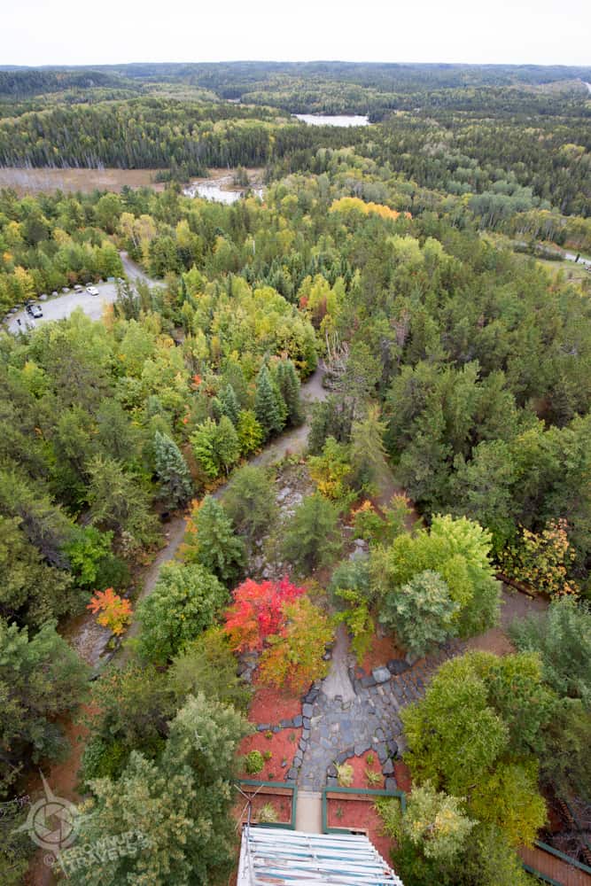
But once you start hiking at trail-level and look up, you can appreciate an entirely different type of “tower”.
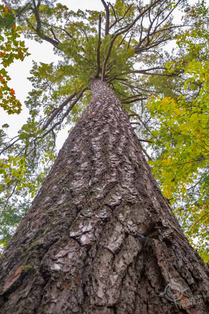
We decided to take a trail that began close to the base of the Fire Tower, the White Bear Trail, which led us along a quiet, pine-needle-covered path that even had ropes to help us navigate the steeper parts.The scent of pine was everywhere, and the only sound we heard were the chirps of birds and squirrels overhead.

With towering trees on the trails, and epic views from the tower, Temagami’s Caribou Mountain certainly took this hike to new heights.
Hiking Reason #3: A Devilish Secret

After the view from the Temagami tower, the bar was set pretty high for the rest of our hiking adventure, but Henk and I didn’t have to go far to find another lookout that was impressive in a different way. Only 20 minutes’ drive north of Temagami is one of Temiskaming Shores’ best-kept secrets: the spectacular panorama visible from the top of the cliffs of Devil’s Rock. Here, shear rock walls rise 300 feet straight out of the waters of Lake Temiskaming, giving you uninterrupted views across Lake Temiskaming to the shores of Quebec that lie on the opposite side.
Even for someone who isn’t particularly afraid of heights, this kind of crazy topography is enough to give anyone vertigo, or at the very least a healthy respect for Mother Nature.
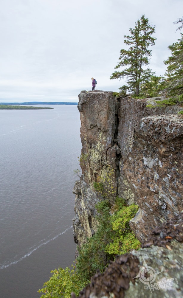
(That’s me up there, respecting Mother Nature. Henk? He’s perched on another rock taking the shot and making ME nervous!)
There are two different trails that take you to Devil’s Rock, one that is a longer, steeper uphill climb, and a shorter one with a more gradual slope. Both take you to the same overlooks, where you can hike along the edge between lichen-covered trees.
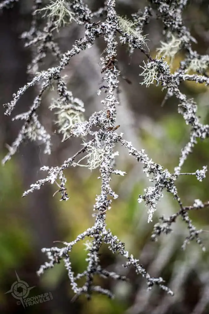
Lichen grew on the branches and trunks of the evergreens on the trail up to Devil’s Rock
The trail is rugged and rocky, and you’ll need to pick your footing carefully – especially if you venture near the edge, for obvious reasons. And if the reason to be extra-careful here isn’t obvious enough, there’s a cross and a memorial to remind you of a tragic misstep taken by a teenager a few years back.
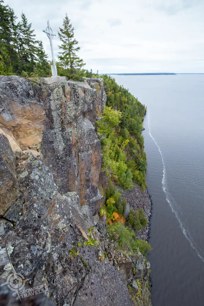
When it comes to my ‘spectacular view’ criteria for a hiking reward, Devil’s Rock over-delivered and literally took my breath away.
Hiking Reason #4: A Cup That Runneth Over
Treetop views of Manitoulin Island from the Cup and Saucer Trail
The Cup and Saucer Trail on Manitoulin Island really does offer something for everyone with its panoramic views and length and variety of trails. In fact, you’re going to want to come back more than once if you want to take it all in. Henk and I can say this, because this was our second trip to Manitoulin to hike this trail, and on this visit we discovered two things: 1) we hadn’t actually reached our East Lookout destination on our first visit and 2) when the Cup & Saucer trailblazers label a route the ‘Adventure Trail’, they aren’t kidding.
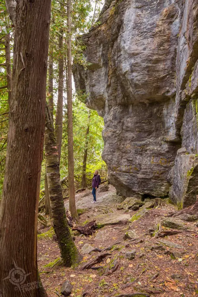
The main trail of the Cup and Saucer begins with a pretty, shaded route that takes you up to the top of this northern extension of the Niagara Escarpment where it rewards you with some of the best views on Manitoulin Island.
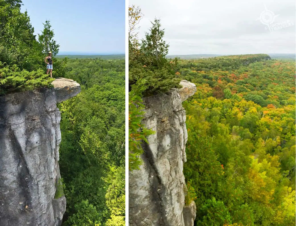
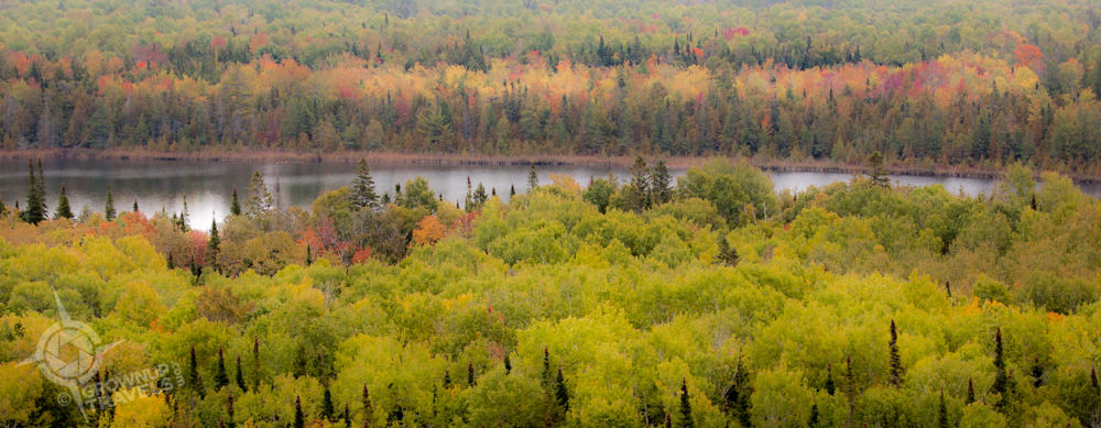
Summer and autumn shots from our two trips to the Cup & Saucer Trail, with the Escarpment continuing in the distance.
It took Henk and I two visits to get to the East Lookout, because we mistakenly stopped short of it on our first hike. (With all the impressive overlooks along the way and this quirky “Bubba Gum Stump” that we mistook for the Lookout marker, it’s easy to see how we could have thought we had found the right place.)
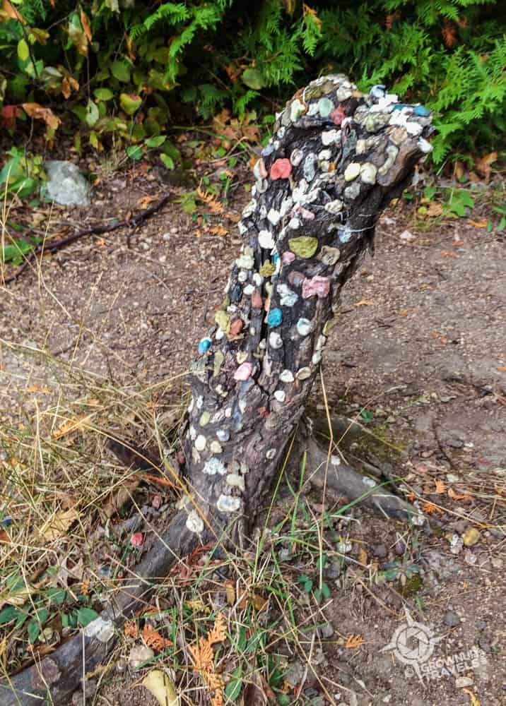
Be sure to continue past what we nicknamed ‘Bubba Gum Stump’ if you want to reach the East Lookout

D’uh. It was here all the time, if we had only kept hiking the first time.

This chipmunk welcomed us when we arrived at the East Lookout – the cutest kind of wildlife!
Having finally found the East Lookout, Henk and I decided we’d add to our Cup and Saucer experience by taking the Adventure Trail nearby to see if it lived up to its name…. and it did.
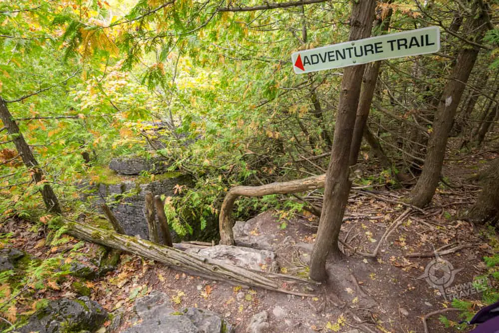
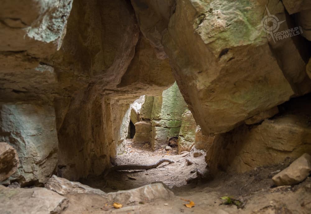
The adventure began with Henk and I climbing 8 metres or so down a rustic wooden ladder that was secured to the edge of the escarpment and that took us down to the trail below. Here we followed a short but rugged, crevice-crawling trail that squeezed us between boulders and along narrow paths that hugged the rock face, and occasionally took us through it.
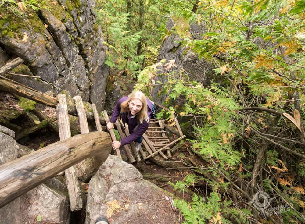
Did I mention these ladders were missing a rung or two? All part of the adventure!
Here’s the part where you actually have to crawl through the rocks in an opening that is only about 3 feet high…
I have to admit that the Adventure Trail was a lot of fun, and gave us a new and different experience compared to our first hike on the Cup and Saucer.
Yup, that’s me under the rocks on the Adventure Trail
In fact, that is the real beauty of hiking the Cup and Saucer: there’s so much to see on its 12-kilometre network of trails, that you’ll want to come back to the Cup many times to drink it all in.
Hiking Reason #5: Salmon Running!
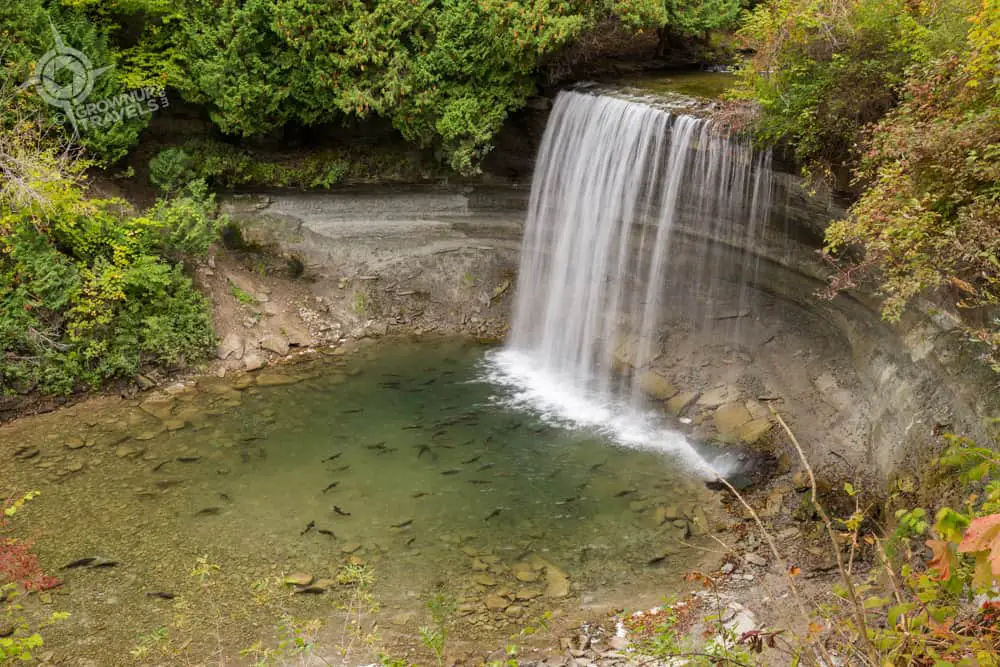
When I hoped to see wildlife on one of our hikes, I was imagining maybe a deer or two (which we did see while driving on Manitoulin Island – yay!) But the real surprise came when we arrived at Bridal Veil Falls to find a pool at the base of the falls so filled with giant salmon that it looked like a carnival fish pond. It turns out that our early October visit coincided with Manitoulin’s Chinook salmon run!
And running they were (almost literally, I soon realized, as I watched these huge fish thrash and swim upriver with their bodies almost entirely out of the water). I had never seen anything like it before, and the experience was thrilling to see in person and up close.
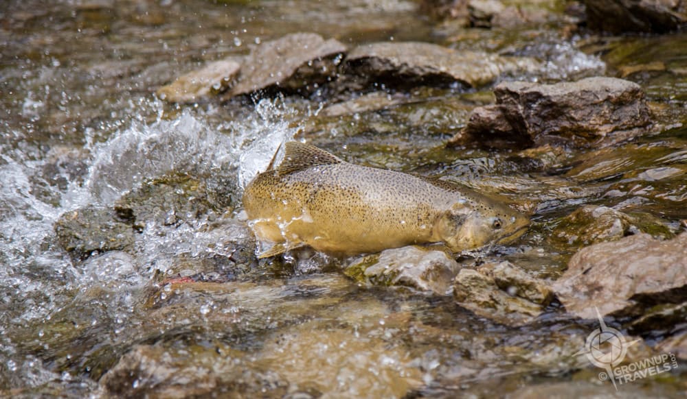
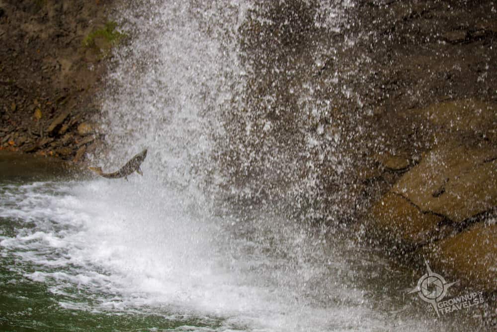
Even though the fish were exhausted after the long journey upriver, that didn’t stop some of them from trying to leap up and over the waterfall before eventually spawning and making their way back downstream.
To see a video of one of these Chinook salmon ‘running’ in the river, click here.
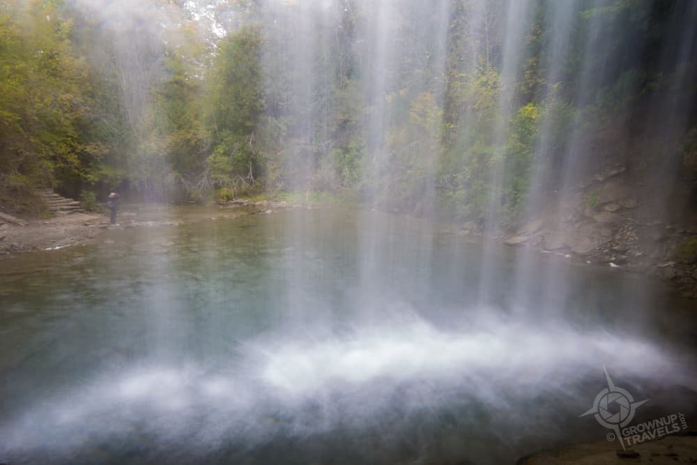
Another surprise at Bridal Veil Falls was how easily accessible they were: a riverside trail led you right to the base of the waterfall where you were within a few feet of the fish (and you could even climb the rocks behind the falls for a photo you don’t often get: one from behind the ‘veil’!)
As if seeing this incredible salmon run didn’t over-deliver on our already-high ‘see wildlife’ criteria, driving back to take the Chi-Cheemaun Ferry to Tobermory, we spotted an entire flock of sandhill cranes! Henk had been keen to photograph these beautiful birds on our first visit to Manitoulin but unfortunately we hadn’t seen any. Finally having this opportunity to photograph a whole flock was the icing on the cake for our adventure, and the perfect way to top off a hiking tour that turned out to be everything we were hoping for and more.
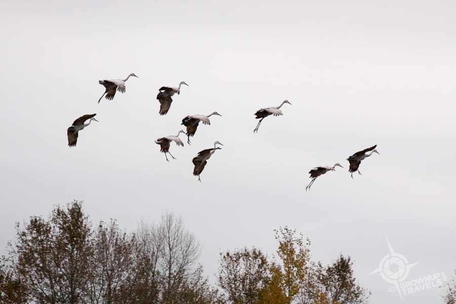
Sandhill cranes lower their ‘landing gear’ when they are coming down to earth
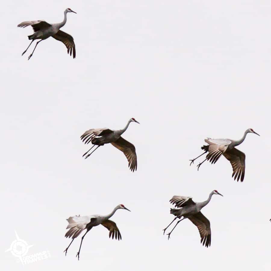
These birds stand about 4 feet tall – so incredible to see an entire flock!
My ‘hobby hiking’ criteria set a pretty high standard for our 5-hike tour, but whatever your own reason for hiking, you are sure to find something to love on each of these 5 Northeastern Ontario trails. Henk and I certainly did.
TIP: Check out the map below to see the locations for our hikes. For more detailed descriptions and practical information on each trail, read more at Northern Ontario Tourism where they are posting a different story for each trail. You can also visit the Ontario Trails Council.
Why not PIN this article of your next hiking adventure?

Jane Canapini is a member of the Travel Media Association of Canada and the North American Travel Journalists Association. She established GrownupTravels.com in 2014 to share information and tips based on personal experience so her readers could get the most out of their travels.


")
")


Wow. You covered a lot of territory for an occasional hiker! Capturing waterfalls is a real talent and you’ve done it brilliantly.
Thank you Alison – I’ll have to give credit to my husband, Henk, who is the photographer (but like all wives, I made sure to remind him to bring the right filter with him!) And yes, it was a pretty comprehensive circuit of trails, but each one was so different that it never felt like we had ‘been there, done that’, even on the Cup & Saucer which we had hiked once before, because it has so many different trails to keep it new and different.
I’m with Henk, Just from the picture alone I didn’t like the look of that tapering structure with a small box balancing at the top! Devil’s Rock looked pretty scary too. God bless whoever the cross was for. Very tragic.
Yes it was very sobering to see the memorial to the teenage boy who lost his life there. I hate to think of one moment’s carelessness or foolishness resulting in tragedy. (and to that end I was very careful on my climb up the tower, too!)
Absolutely gorgeous landscapes! I don’t love hiking, but like you, I will do it if there’s a reward of a breathtaking view(s) and great photo ops like Devil’s Rock.
Yup, I’m all about the Return On Investment, too! And with Devil’s Rock, we even had a choice between a steeper, more difficult trail, and a gentler slope, so you didn’t have to be an expert hiker to get to the outlook.
Who knew hiking North Eastern Ontario was so world class? Bridal Veil Falls looks like something out of an Nat Geo documentary about the Amazon. Great photos!
Thank you so much for the comments, Nathalie! We were completely surprised ourselves at the calibre of hiking here. The whole salmon run thing was a fabulous surprise, too! Talk about perfect timing.
Stunning, breathtaking – I could go on. I just keep shaking my had at these wondrous photos. I will earmark this and hopefully one day be able to experience this in person. How many miles did it take you with all of the hikes?If you wrote it and I missed it, I am sorry. Lovely adventurous post!
Now I’m blushing, Suzanne! Thank you SO much for your comments. And as for the miles, we were very efficient and did all 5 hikes in 4 days, driving about 1500 km (about 900 miles) that included a ferry ride across Georgian Bay in the Great Lakes. It was really a great adventure.
Five hikes in four days was a big commitment for a non-hiker. What beautiful places you got to explore- the photos are fantastic. Almost make me want to hike- and it takes a lot to do that.
I’ll take that as the ultimate compliment, Billie! Thank you from another ‘occasional’ hiker.
Stunning landscape and scenery, I would love to visit this area sometime in my lifetime. It’s breathtaking scenery to hike through.
And with your love of photography, Noel, you’d love Northeastern Ontario. We had kind of crappy skies for doing anything truly epic, but I’m sure you can see the potential!
Like you, I’m an occasional hiker, doing it to get to places I wouldn’t see otherwise. Those Ontario trails look fantastic, for the countryside and the wildlife. Although I did get a bit nervous seeing those pictures of you on top of the rocks!
Yes, I definitely got a certain feeling looking out from those heights, especially when I was at Devil’s Rock. There’s something about being part of a dramatic landscape that makes you more aware of your own insignificant size!
Wow, Northern Ontario is truly amazing. I’ve paddled in a canoe around Temagami ( stayed at Smoothwater Lodge) but didn’t do much hiking. So, it sounds like I need a return visit! I’m not so sure I’m up to crawling through rocks or climbing ladders but could probably keep up with the rest of the trail especially if the reward is a fantastic waterfall!
And I’m the reverse, now, Michele. I’ll have to bring a canoe or a kayak back there and do some padding. Certainly the view of Devil’s Rock from the water would be worth it alone!